Friday, December 30, 2005

The Tongariro Crossing, Part 2


When you get to the top of the first, fairly gentle incline and then the second, difficult lava-rock scramble, you're in a volcanic crater, which basically feels like a Martian landscape. Some people stop for lunch there, but not us. No, we pushed on, up the next 500 meters, to the peak of the climb, over another crater.

In the pictures here, you see that crater and some pictures taken from about mid-way up the second hill, which is featured in the picture taken from the same elevation as the people on the flat crater surface. If you look closely, you might be able to see the clouds descending to the level of the hike.

Thursday, December 29, 2005

The Tongariro Crossing, Part 1


As I mentioned before, the Tongariro Crossing is widely considered the "Best 1-Day Hike in New Zealand." It's pretty cool, though I thought that the Rob Roy was at least as good (though it was really a half-day-er).

We postponed our trip up there (central North Island), mainly because of oversleeping and lack of planning on the day we should have gone. As a result, while the picture from Lake Taupo in the last post reveals good weather, it turned on the tramp the next day. The way up, pictured here, was fine. By the time we got to lunch at the Emerald Lakes, the cloud cover had lowered to our elevation, giving us about 1.5 hours in the fog and keeping it cloudy the rest of the day. So we missed a lot of supposedly spectacular views, and even when the weather was good, the clouds partially obscured the mountain tops, which is a shame. The day before, driving past, they were remarkable, but we figured, "Why get a picture from the road now, when we'll be up close tomorrow?" Bad decision, since we never saw the peaks again.

The Tongariro Crossing is a track that goes through three active volcanos (which provided the backdrop for Mordor in Lord of the Rings--look for similarities in the purely conical mountain in the one picture). It's a lunar landscape, which is beautiful, and the mountains themselves (when you can see them) are impressive. Finally, once you're up there, you get amazing views of a large part of New Zealand.

The hike itself is rigorous--the most rigorous Julie or I has ever done. It is not longer than anything we've done, but it's harder--while only 17km (10.2 miles), that takes 7 hours when you go at a good clip.

In the one picture, you see Julie's ascent up the first part of the climb. You climb up to the "saddle" in the middle of the picture. All the little colored dots on another picture are people, climbing up a very long and steep and straight ascent that is more careful volcanic rock scramble than hike. Once you get to the top, you're in a crater, and then you've got another huge and fast ascent, for a total of 1000 meters (do the math). Then it's another crater, and then the beautiful Emerald Lakes. Finally, the descent begins, which is more brutal than the climb, especially for those of us with tendonitis in the knees. Kiwis apparently have something against switchbacks, and they have a hankering for huge drop-offs on their stairs. Our knees were pulverized, but it was a beautiful hike.

Rotorua and Taupo


The Tongariro Crossing is near Lake Taupo (central North Island), where my dad and I in 1996 fished while Mt. Ruapehu, one of the active volacones making up Tongariro's three peaks, erupted. Before doing the crossing, Julie and I stopped at Lake Taupo, and then continued onto Rotarua (another hour north, about 6 from Wellington), which is known for two things: lots and lots of geysers and hot springs, and being the Maori cultural culture.

It is common to take in a cultural event or two, usually involving some sort of ritual, song/dance/Haka, and Hangi (feast). We decided to go to what turned out to be the glitziest of them all, the Tamaki Maori Experience, an event/center put together by the Tamaki brothers who thought that visitors needed to get an "authentic" feel for traditional Maori life. They've apparently grown quite prosperous in the process. Anyway, this was one of the more Disney-fied events out there, I think, but we still got something out of it (dance/Haka and food come to mind).

The End of a Great Trip


The Abel Tasman Experience was a disappointing way to end the trip. By the next morning, Day 8 of what should have been a 9-day journey, we were done. We called the ferry, hoping to move our booking up a day. Thankfully they had a spot for the Subaru and us.

All-in-all, though, it was a great trip. The biggest lesson is that NZ requires flexibility on the weather. It will rain when you're here. Even in the sunniest spots (like Abel Tasman), the locals say that at the peak of summer (February), it will rain. So make your plans flexible. The rain only caused four major losses: Abel Tasman, a night at Aoraki (but this was a loss from which we profited an excellent second night in Wanaka), and views on two drives, between Wanaka and the West Coast and at Kairoura. That was a lot, but we also had great times and mostly great weather at Wanaka, the glaciers, and up the West Coast. And we saw some amazing things that make me feel lucky to live here.

Finally, it ended with a very nice ferry ride back. After another crummy day in Nelson, Picton, the ferry town on the South Island, offered a pleasant couple of hours. Then we had a beautiful sunset cruise across the Cook Strait back to Wellington, seen in the pictures here. Julie's holding her wine as the sun goes down; I'm behind the camera enjoying a few beers. It is really a gorgeous ride in itself if the weather's good (which it wasn't on the way down, but was on the way back, thankfully). We arrived home the night of Dec. 20.

Tomorrow we're off on the last adventure before Julie leaves on New Year's Day. Up to Rotorua for a Maori Hangi (feast) and hot springs, and then, weather permitting, to do the Tongariro Crossing, an 8 hour hike through a couple volcanos ("Mordor" to fans of Lord of the Rings), which is supposed to be the best one-day tramp in NZ. Despite some awesome sun most of the time we've been back in Wellington, they're predicting rain the day we're supposed to be at Tongariro, so keep your fingers crossed. They say not to do the hike if it rains, since it basically turns into a long walk in the fog!

Bad, then Great, then Really Bad


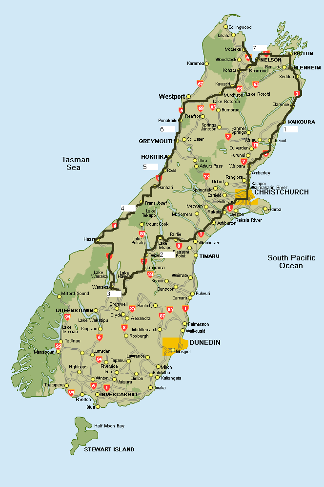
Our final destination: Abel Tasman National Park. One of the finest sea kayaking spots in the world. (Stop #7 on the map.)

Now on day 7, we woke in Nelson to rain. Not good, but we only had a 1-hour drive to get to the park to arrange things for kayaking the next day, so we headed to late morning wine tasting (Nelson being one of the main wine-producing areas in NZ), and lunch. If you're ever there, The Grape Place is excellent. They've got a couple of wineries' tasting rooms, some cool art, and most importantly, we had a first-rate lunch there. Put us in a fine mood, despite the rain.

We departed after lunch, and right then the sun broke through! We did the beach on Rabbit Island for about 2 hours, then headed to Motueka to resupply food, and made one final stopover on the beach in Kaiteriteri. The pictures seen here are from Kaiteriteri, which is just 7km east of the Park. It was sunny, and the lagoon there (no word on how much the little white house will go for), promised great things. Abel Tasman is basically just an extended series of ocean-front lagoons, which you explore via kayak or on water taxi. We were excited for a two-day excursion on sea, ending with about 4 hours of hiking, through this paradise.

We got to Marahau, the gateway to the Park, that afternoon. Still remarkably sunny.

Then the first hiccup arrived. We'd originally planned on this being our first stop on the whole trip, but rain caused us to move it to the end and do our whole trip backwards. The upshot was that I missed that the change meant that to do our whole kayak/hike, we'd miss our ferry back to Wellington. So we had to cut it back and miss the hike at the end, the outfitters explained to us. But no worries, it would still be a great trip. We made camp, excited about the excursion, and had an early night.

The next morning was cloudy. When we arrived at the kayak-rental place, they told us the winds would get up to 30 knots that day, and they strongly recommended that beginners like us not attempt it. That scared us (we didn't want to drift to Antarctica), so we made a decision: we'd do our training that morning, spend the day merely backpacking about 3 miles in, and then return to pick up kayaks for only a one-day-er the next day. That would cost us some dough, but we wanted a good experience. This seemed like a particularly sage decision during the actual on-the-sea portion of our training. The winds, at a mere 10 knots, were causing us problems, and we were clearly unskilled, so backpacking seemed like the wise choice.

So we packed our bags (with way too much stuff), and that afternoon set out for our short, 1.5 hour hike along the coastline. Again, it was beautiful. Then we got to our beach camp. Nice beach. 15 minutes later the rain started. We tucked ourselves under a tree, hoping to wait it out. 2 hours of rain later, we were screwed. Our bags and our bodies were soaked. We hate camping in the rain, let along soaking in a downpour from which your gear cannot recover, so we made a bold choice: we'd hike out. We were bummed, but then the hike back through what was now a complete mud-river and full-on downpour carrying waterlogged packs converted that into pure unhappiness.

We promptly gave up on the sea kayaking. A total bust. We got a 50% refund and decided to head to nearby Motueka for the night, to find some shelter and give up our vow to not get another motel. After warming up on some yummy Indian food and finding comfort in a drink, we searched for a place to stay. The rain had fully booked the town, so we decided to drive the hour back to Nelson. The drive was awful--pitch black, sheeting rain, high winds, lots of hydroplaning on very winding roads, low visibility. This was the worst rainstorm I've ever seen, and I grew up in Oregon and endured tornado season in Memphis. We didn't want to stay in Nelson again, but we decided to try to find a place there simply because there was no other option. But now it was 11pm, and it turns out that most of the motels in NZ close their doors at 10pm. After fruitlessly searching several places, we finally stumbled upon the best one yet. It had a spa bath in the room, cable TV, and a dehumidifier to dry out our clothes (some of which might not recover, it seems).

So that was a nice ending to what was a very disappointing day. The kayaking, Abel Tasman, the sunny beaches, all never really materialized, except what you see in the pictures here. What a tease.

Pancake Rocks are Cool


In Punakaiki, sort of the last major unique stop on the West Coast, heading north, before you turn back into the mountains, the main attraction is the Pancake Rocks. It's a bit like Arches or Bryce Canyon in Utah, except it is right in the water (and thus water- rather than wind-carved). A few particularly cool things about it:

1) The waves explode in the rocks' caves in a spectacular fashion, though not a fashion captured by me on camera, sadly.
2) As Julie pointed out, unlike Arches, the crashing water lets you see the rock formations being formated right in front of you.
3) They don't know what causes the pancaking feature (the flattened layers seen in the pictures). One of the "last geological mysteries."

Just north of Punakaiki is Punakaiki Beach Camp. We planned on staying there originally, and it looked really nice as we zoomed by. Since it was sunny, and it was still early, we decided to make more time and head into the Buller Gorge and up the mountains to Murchison, hopefully to do some whitewater rafting the next day (this was day 6 already). After the Subaru Debacle, this was our Second Big Mistake. The weather, spectacular in Punakaiki, turned bad in the Gorge. They were predicting more bad weather the next day, and Murchison was boring, so we decided to skip the rafting altogether, and just head all the way to Nelson, on the north coast. That's a long day's drive, from the Glaciers to Nelson (stops 4 and 7 on the map, respectively--5 and 6 are Hokitika and Punakaiki).

The merit of this plan was that we could do some wine tasting in the Nelson area the next day, before heading for our final destination, sea kayaking (or so we thought!) in Abel Tasman National Park. The demerit was that we would have had a great sunny afternoon and warm evening in Punakaiki, which we ended up trading for a night (night 6) in rain-full and campsite-unfriendly Nelson, a town we both decided was overrated, given its sizeable reputation. So we found our second motel of the trip (and our last, we vowed), which was a crummy rathole. And we spent our evening unexplainedly glued to a showing of the godawful movie "Jersey Girl." The low point of our trip in many ways.

But the West Coast, capped with the Pancake Rocks, is definitely a must see. Beautiful.

The West Coast Itself


Departing early morn' after the treacherous night in the Subaru, and facing another great, sunny day, we were excited about the trip up the West Coast. It draws comparisons with Big Sur, which is one of my favorite drives, and promised several other unique stops along the way.

One of the first is the town of Hokitika. If you're ever in NZ and want to really look at the local art scene, stop here. There are lots of cafes, and a great fudge shop, and it's really a town you could spend 24 hours in. There are tons of great artists working here, primarily in Jade and native woods. It also has nice views--though it's on the coast, you can see (in the one picture with buildings in it) how its lagoon sits in the shadow of the Southern Alps.

The other pictures are from various stops along the West Coast north of Hokitika. The comparisons to Big Sur are not overstated--this trip exceeds it in some ways (and not in others). Great cliffs, mountains, rock outcroppings, and a beautiful coastal road. If you ever want to invest in a stunning piece of real estate, there are tons of fresh opportunities here.

Our plan was to spend the night in Punakaiki, just after the Pancake Rocks that will be seen in the next post to come. There's a beautful beach camp there, and the weather was great. We should have stuck with that plan. But after getting our 5am start, it was so early in the day that we were tempted to make our second big mistake of the trip...

Fox Glacier and the Beach


After spending the morning at Franz Josef Glacier on Day 5, we headed about 25km south back to Fox Glacier for the afternoon. But before doing the glacier itself, we headed to a great picnic spot south of the town of Fox on an unsealed road for lunch. It was beautifully sunny and warm there, in the picture with the picnic field in the foreground and the cloud-enshrouded Fox glacier in the background.

What's hard to overstate about the West Coast experience is how close the mountains and glaciers are to the shoreline. No more than 10 miles away from the frozen ice of Fox Glacier is Gillespies Beach (apparently no apostrophe needed), further on down the unsealed road. We cooked ourselves in warm sunlight, right under the hole in the ozone layer, dipped ourselves the very blue Tasman Sea, and then headed back up to the glacier later in the afternoon, all of which is pictured here.

Back at the glacier, we got another rainstorm, which we waited out for about 2 hours before the short hike up to the ice (though as the pictures show, it was still cloudy). Again, you can walk right up to the glacier's terminus unguided, and the cool thing about this one is the gaping mouth of the huge river it spawns. That river, the proximity to the coast, and the blazing NZ sun notwithstanding, the glacier can still grow because of the huge amount of precipitation delivered by the volatile coastal weather.

At the end of the day, it was off to Lake Matheson for sunset views of Aoraki, a restaurant-cooked meal on a dusky porch, and then back to Franz Josef for the Subaru Disaster.

Tuesday, December 27, 2005

Franz Josef Glacier


As you head north on the West Coast, the first of the two main coastal glaciers you come to is Fox. But by then we were getting pounded by an industrial-strength rainstorm, so, with nothing to do, we thought we'd head up to the second one, Franz Josef, to see what was happening there. And guess what? More rain! We decided that rather than getting drenched, after three nights (one in a backpackers and two in a tent), this would be a good time to treat ourselves to a hotel room, in the town of Franz Josef. We finally cleaned up, cooked a real-ish dinner, and hoped for the clouds to break the next day.

As we climbed out of our hotel room the next morning, we were treated to views like the ones you see here in the picture containing buildings. Looks like an awesome place to live. The rest are from the Franz Josef glacier itself. Most importantly, not a cloud in the sky! So we got in four different hikes/walks, beachtime (more on that in the next post), and good food outside. All-in-all, day five was a great day.

In one picture here, you'll see some hikers climbing the face of the glacier. We planned on joining one of those hikes the next morning (day 6)...but we ran into problems that night (night 5). Rather than camp, we were goofing around so much on our one full day (day 5) in the area that things got too late to make camp north of town at the Dept. of Conservation campsite (the sunset walk around Lake Matheson contributed to a late departure). So we unadvisedly decided to take a stab at sleeping in the Subaru. Back in the old days, Julie and I often crashed in the back of my pickup, El Rojito, so we figured it wouldn't be a problem.

Neither of us noted, until it was way too late to change our plans, that the Subaru's back area, even with the seats folded as intended to allow sleeping, is about a foot shorter than the length of my old pickup's bed, and, coincidentally, me. So I 'slept' that night by alternating between folding my legs in right angles at the knees, putting them up on the front seat's headrest, and, to Julie's dismay, going diagonal. She barely got a wink. We were up at 5am. Upon deciding that we were in no shape (in terms of energy or safety-consciousness) to do a glacier hike, and given that the weather was nice, the drive up the West Coast to our next stop seemed like a better option. We're both bummed about the Subaru debacle, and we wish we'd been able to do the glacier hike. (Lesson: don't try to sleep in a Subaru Legacy.) At least you are permitted to walk, as we did, right up to the terminus of the glacier without any guide, so we did get a great perspective on the ice.

And that second night had great views of the stars, featuring the Southern Cross.

Monday, December 26, 2005

The Coastal Glaciers


Next up--nights 4&5--is the beginning of the West Coast, as the west coast of the South Island from Milford Sound north is known. The drive from Wanaka to the two famous glaciers on the West Coast, Fox and Franz Josef, is supposed to be great, and while we occasionally got some spectacular glimpses (particularly around Lake Hawea and once we scrambled out of the mountains and arrived on the Tasman Sea), we also lost a lot of views to the clouds and fog. Still a fun/challenging/difficult drive, though. On the way was the cloudy coastal vista in the picture here. While Big-Sur like itself, this is just a teaser for what's to come from the spectacular West Coast drive north of the glaciers.

Once you get to the glaciers, there are three big attractions to take in: views of Aoraki (otherwise known as Mt. Cook), Fox Glacier, and Franz Josef Glacier (area #4 on the map below). I'll put them in separate posts. Aoraki is featured here. The views are from the Lake Matheson area, known for its famous postcard-like (and plain-old postcard) scenes.

Sunday, December 25, 2005

Funny Interlude

Here's a little holiday fun to mix in with details of the South Island trip. This story fairly represents one of the potential nightmares that keeps academics awake at night.

The Glacier Itself


Okay, so I babbled about the hike in the last post; now a few words about Rob Roy Glacier itself. Very impressive. It actually covers a very wide area, with tons of waterfalls, so it was very different than the other glaciers with which we got up close and personal. The vastness of it couldn't be captured in any one picture, so you'll have to take my word for it.

There was a nice field to relax in and absorb the scenery, and we had great weather, depite the clouds cloaking the glaciers in the pictures you see. (Unfortunately, that's true of many of these pictures--we were drenched in an incredibly strong sunlight, but clouds seem to populate my pictures.)

And at two different points, we heard a very loud rumble, followed by two glacial avalanches! I'm guessing that's kind of rare; one was captured in the bottom-center of the third picture you see here. (As usual, click the picture to bring it up in its own window, and then click again to maximize it.)

Final thought: it's hard to get a sense of scale from these pictures, but the waterfalls were very tall, the glacier and mountain peaks huge, and so forth. So try to imagine it as very, very big.

Day 3: The Rob Roy Glacier Hike


Rob Roy Glacier is cool. Much less publicity than Fox and Franz Josef (more on them later), but in some ways cooler. It's a 4-hour hike (or "tramp") roundtrip, lunchtime not included. The hike is billed as moderate, but that's conservative, as the first part is rigorously uphill. All in all, it's stunning.

You start in a serene sheepfield, cut through by a river whose unique blue color is captivating. Then you cross a suspension bridge and head up the hill, overlooking a valley with steeply sloped mountains. Then it's into the very nice forest along a different river, with hints of the many waterfalls and glacier to come. When you come out at the end, it is well worth it. Great place for lunch, but watch out for the Kea birds, which are huge, eagle-like things that try to grab shiny objects like chip bags and cameras.

The hike is about one hour from Wanaka, mostly on unsealed road. The Subaru served us well on that trip, including crossing 8 fords, most with active streams, such as the one depicted here.

The Wanaka/Queenstown Dispute


Queenstown is definitely the gateway to the Southern Alps. It's a beautiful place (see post here), and it has just about every adventure you could want, with plenty of restaurants and hotels, and even two casinos. And it is rapidly exploding in population, giving it a vibrant feel. But there's the rub. Many locals prefer Wanaka, just under an hour to the north, which boasts nearly as many activities (though fewer vendors) and a more laid-back feel. So there's a friendly rivalry between the two towns.

I don't know which to choose. But in our 9-day trip, as we arrived for 48 hours in Wanaka on the second night, Julie and I thought that the best overall experience was Wanaka, including the surrounding hiking--see the Rob Roy Glacier hike in the next posts. If you want a more peaceful visit, go to Wanaka. If you want a more lively visit, go to Queenstown. You can't go wrong in either place.

One thing is for certain: Wanaka has the best ($7 night/person) car-camping spots I've ever seen. By far. Just look at what our tent and chairs looked out at--the mountains, the river. Just gorgeous. Julie is rightly enjoying herself in the one pic. (For those on the lookout, the campground is in Albert Town, just outside Wanaka as you cross the one-lane bridge.)

The top picture is Lake Wanaka, the view from dab-smack in the middle of town; the next two are from our campsite, and the last from a nearby trail (or "track" as they're called here).

I just realized it's now officially the 25th here, so Merry Christmas and Happy Hannukah to everyone!

Friday, December 23, 2005

Day 2: From Kaikoura to Wanaka


The rain was heavy the next morning in Kaikoura, prompting more worries about the quality of our trip. Trouble sleeping had us on the road at 6am, and by late morning we passed through Christchurch on our way up into the Southern Alps. Still more rain. Finally, just as we were nearing our destination region--a triangle formed by Mt. Cook/Aoraki, Lakes Tekapo and Pukaki, and Wanaka--the sun came out. Smiles all around.

After eating lunch at Lake Tekapo and relaxing on the beach at Lake Pukaki, we decided not to head to Mt. Cook, as it was covered in clouds. So we headed to two nights in Wanaka, which will be the next post. Lakes Tekapo (the pic with the tree in it) and Pukaki (the other three pics) are noted for their turquoise waters. In fact, the glacial streams color most of the water down there this amazing blue-green color that unfortunately didn't get maximized in the pictures. But still, beautiful spots.

This is stop #2 on the map below, and remember to click on the pictures (and the map) to get them on their own page, and then click again for full resolution versions.